Research profile
I am a field biologist, with expertise in the taxonomy and ecology of a wide range of animal groups, (grasshoppers, butterflies, dragonflies, amphibians, reptiles, birds, mammals). I build up primary biodiversity databases, with a special focus on Mediterranean mountainous ecosystems.
International collaboration, independence, ecological breadth, and a consistent focus on providing solutions to major conservation problems are the four points that depict my research profile.
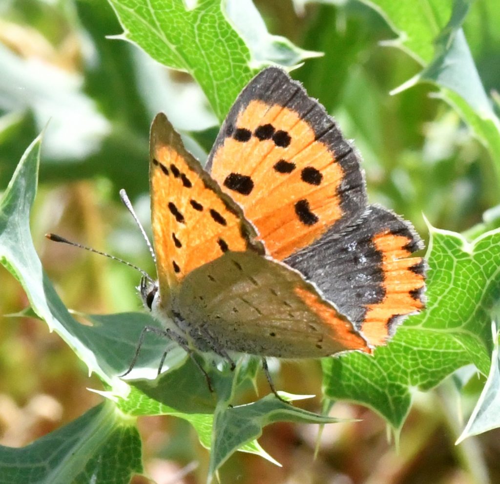
The last research projects I have initiated concerned the sustainable spatial planning of wind farms without undermining biodiversity goals, the delineation of roadless areas as pristine landscapes of high ecological and aesthetic value that should be preserved as such, and several projects on the conservation of endemic and threatened grasshopper species. I have also recently initiated “apollo” the first voluntary citizen-science scheme for monitoring greek butterflies.
Social profile
It is my belief that biodiversity conservation and ecological justice are the greatest challenges of our century. Science can provide real answers to our biodiversity crisis-era; we do not have the luxury to do science without implementation and vice versa.
For this reason, I am active as a conservation biologist, attempting to apply scientific findings in practice and to bridge the gap between local and international policymaking. I am a member of several international and national scientific societies and NGOs, having also chaired the Education Committee of the SCB-Europe and having organized the first international summer school on conservation biology for five years.
I am together with Haritakis and we have a lovely daughter, Myrto. If I was not to be a scientist, I would be a musician or a book writer of novels and fairy tales…. Who knows, maybe these dreams will come true one day…
Research interests
Biodiversity conservation: Indicators, reserve design techniques, biodiversity patterns and mapping, biodiversity under climate change, the impact of human-originated pressures on biodiversity.
Community ecology: Diversity patterns, ecological structure, habitat suitability, and conservation management of terrestrial animal communities: grasshoppers, butterflies, herpetofauna, birds, and mammals.
Conservation biology: Endangered species conservation, protected areas management, windfarm spatial planning, roadless areas and wilderness preservation.
Environmental policy: Science-policy interface, implementation of Natura 2000 network, wilderness integration to legislation,, sustainable game management
Milestones & Education
University of Ioannina. Department of Biological Applications & Technology. Head of the Biodiversity Conservation Lab.
University of Ioannina. Department of Biological Applications & Technology
University of Patras. Department of Environmental & Natural Resources Management. 2010-2016. Associate Professor in the same Department (2016).
University of Ioannina. Department of Environmental & Natural Resources Management. 2006-2010.
University of Ioannina. Department of Environmental & Natural Resources Management. Lecturer under contract [Teaching the core courses: Plant ecology, Environmental planning and sustainable development.] 2002-2006.
Universität Erlangen-Nürnberg. Institut für Zoologie II. Summer visitor professor (Assistant Professor). [Teaching the postgraduate course: Applied ecology-biodiversity conservation.] July-August 2002.
Technological Institute of Epirus. Department of Fisheries. Lecturer under contract [Teaching the core course: Biology]. 2001-2003.
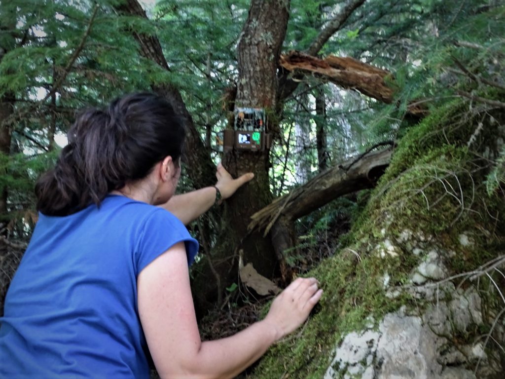
WWF-Greece. Project on the conservation management and monitoring of Balkan chamois (Rupicapra rupicapra balcanica) in Northern Pindus. 2001-2003.
Université Catholique de Louvain, Belgium. Department of Biology, Section of Ecology and Biogeography. Ph.D. on biodiversity conservation with grade "The greatest distinction". Doctoral thesis: «Methodological Approach on Assessing and Optimizing the Conservation of Biodiversity: a case study in Dadia reserve (Greece) ». Supervisor Prof. Ph. Lebrun. 1997-2001
Université Catholique de Louvain, Belgium. Department of Biology, Section of Ecology and Biogeography. Diplôme d’Etudes Approfondies en Biologie (DEA) with grade « Great Distinction». MSc thesis: «Passerine and Orchid diversity assessment in Dadia forest reserve, N.E. Greece». Supervisor Prof. Ph. Lebrun. 1997-1999.
Αristotle University of Thessaloniki, Greece. Department of Biology. Diploma in Biology with grade «Excellent» (8.53/10). Diploma thesis: «Assessment of pollution levels of Lasne and Argentine streams (Belgium) in terms of biological indicators”. 1992-1996.
Université Libre de Bruxelles, Belgium. Department of Biology. Erasmus student (12 months). Attending undergraduate and post-graduate courses on land management, environmental management, ecology and biogeography. 1995-1996.
Research projects
Goal: DEMO aims at building the ecological knowledge base needed for assessing the conservation status of three steno-endemic and globally threatened high-altitude Orthoptera species of Greece of the genus Parnassiana: P. parnassica (CR), P. tymphrestos (EN) and P. coracis (VU). The project covers their global distribution area and attempts to solve the taxonomic problem of P. coracis vs P. tymphrestos in genetic terms, map the global distribution of the species, investigate the species' habitat requirements, assess the species population status, assess pressures and threats for the species and create the knowledge base for the conservation management of the species. Period: 2023-2024. Funding: NECCA-National Environmental and Climate Change Agency. Institute: BCL - University of Ioannina. Role: Coordinator
PhD title: Ecology and conservation of mountainous Orthoptera communities, with emphasis on endemic and threatened species (Greece). Period: 2023-2026. PhD excellence grant by HFRI-Hellenic Foundation for Research and Innovation. BCL - University of Ioannina. Role: Coordinator & PhD supervisor.
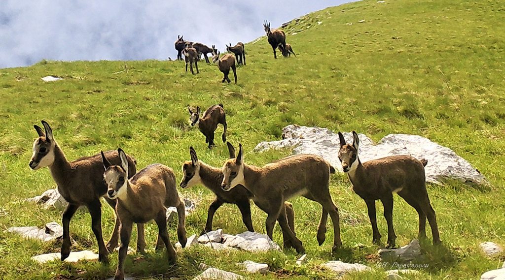
PhD title: Balkan chamois (Rupicapra rupicapra balcanica) ecology and conservation in Greece. Period: 2023-2026. PhD excellence grant by HFRI-Hellenic Foundation for Research and Innovation. BCL - University of Ioannina. Role: Coordinator & PhD supervisor.
Goal: Predict the ecological traits that make butterflies adaptable to climate change. More info in the project website here. Period: 2023-2025. Post-doc excellence grant to Dr.Dina Zografou as the Principal Investigator by HFRI-Hellenic Foundation for Research and Innovation. BCL - University of Ioannina. Role: Coordinator
Goal: Study of the ecological requirements of the Epirus dancing grasshopper (critically endangered and endemic species) and proposal of management measures to restore its populations and improve its conservation status in Epirus area (GR2120001,GR2120002, GR2120003, GR2120006,). LAC2 project complements LAC project, covering the global distribution area of the species. Period: 2023. Funding: NECCA-National Environmental and Climate Change Agency. BCL - University of Ioannina. Role: Coordinator
Goal: Mapping the roadless areas of Greece (over 1 sqkm) and providing to the Greek government and society an open spatial database of the roadless areas of Greece, including whole islands, as a tool to delineate and protect wilderness areas of high naturalness, ecological and aesthetic value. The project concludes to suggestions on integrating its outputs in the national and international environmental policies towards minimizing fragmentation and land use change, in the frame of the new biodiversity strategy in the EU. Period: 2021-2022. Funding: Green Fund of Greece. Institute: BCL - University of Ioannina. Role: Coordinator. More info here
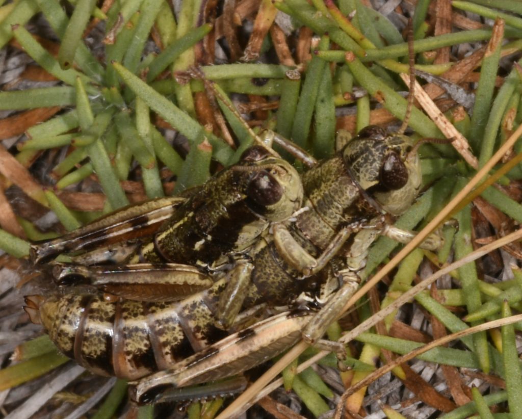
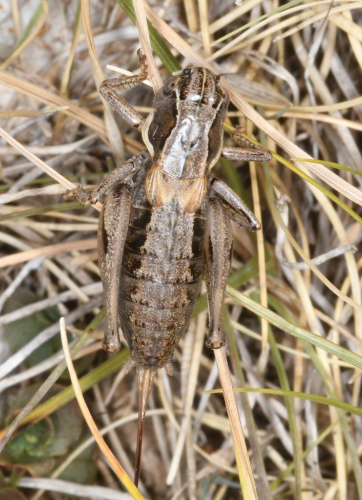
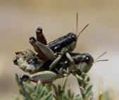
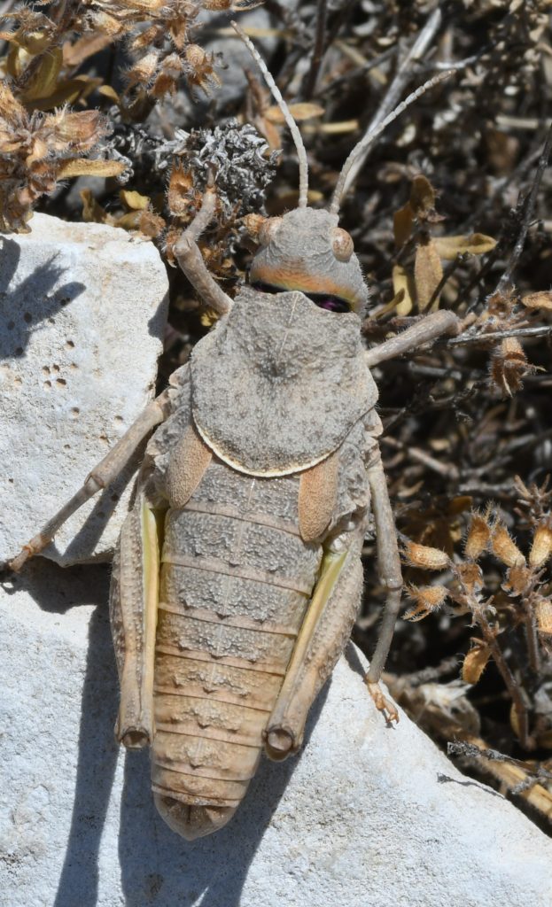
Goal: Study of the distribution and ecological requirements of fourteen important grasshoppers in the mountains of Oiti and Tymphristos and suggestion of conservation measures for two species that are both endemic and endangered (EN) - Parnassiana tymphrestos and Oropodisma tymphrestosi. Period: 2021-2022. Funding: Management Agency of Oiti National Park. Institute: BCL - University of Ioannina. Role: Coordinator. [Photo O. tymphrestosi mating]
Goal: Study of the distribution and ecological requirements of the butterfly of Community interest Papilio alexanor in two Natura 2000 sites (Parnassos and Giona mountains) and suggest conservation measures to improve its population status and conservation degree. Period: 2021-2022. Funding: Management Agency of Parnassos National Park. Institute: BCL - University of Ioannina. Role: Coordinator.
Goal: Study of the distribution and ecological requirements of eleven important grasshopper species in Parnassos National Park and proposal of conservation measures for four endemic and endangered species: Parnassiana parnassica (CR), Oropodisma parnassica (EN), Stenobothrus graecus (EN), Glyphanus obtusus (EN). Period: 2021-2022. Funding: Management Agency of Parnassos National Park. Institute: BCL - University of Ioannina. Role: Coordinator. [Photo Glyphanus obtusus]
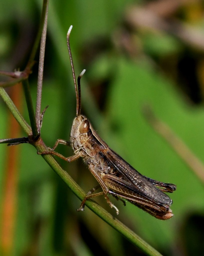
Goal: Study of the ecological requirements of the Epirus dancing grasshopper (critically endangered and endemic species) and action plan to restore its populations and improve its conservation status in the basin of Pamvotis Lake. Conservation actions will be implemented and their efficiency will be assessed through monitoring in collaboration with the Management Agency of Pamvotis Lake staff. Period: 2021-2023. Funding: Management Agency of Pamvotis Lake. BCL - University of Ioannina. Role: Coordinator. [Photo male Epirus dancing grasshopper]
Goal: Study of the distribution and ecological requirements of important insect species in Mitsikeli and Nemertsika mountains and the broader area (Ioannina, Pogoni). It targets the butterfly Ephydrias aurinia, the endemic cave-cricket of Perama cave Dolichopoda graeca, the species of Community interest Paracaloptenus caloptenoides and the endemic and endangered species Pryonotropis willemsorum. The study concludes to a spatial database and data on the species ecological requirements with concrete conservation measure suggestions where applicable. Period: 2021-2023. Funding: Management Agency of Pamvotis Lake. Institute: BCL - University of Ioannina. Role: Coordinator. [Photo Dolichopoda graeca].

Goal: The convergence of climate and biodiversity policies, in the field of wind farm development. The project WIND produced a sustainable scenario of sitting windfarms, which minimizes the cost for biodiversity and natural landscapes, while succeeding to overcome the national climate goals of energy production from windfarms by 2030 and beyond. Period: 2020-2021. Funding: National Center for the Environment and Sustainable Development. Institute: BCL - University of Ioannina. Role: Coordinator. More info here
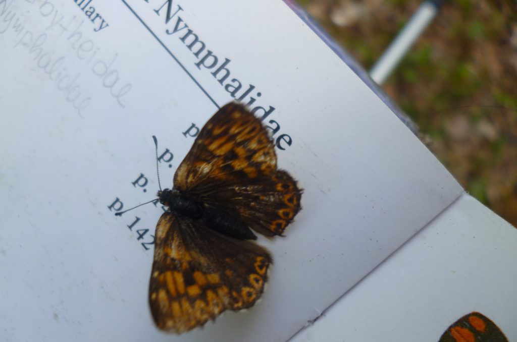
Goal: Connect science with society, with a focus on butterflies, for the mutual benefit of the citizens themselves, science and the Greek State. The projects sets up the first methodological guideline and provides the means to set up the first national citizen science scheme for recording and monitoring butterflies in Greece.
Period: 2019-2020. Funding: National Center for the Environment and Sustainable Development. Institute: BCL - University of Ioannina. Role: Coordinator. More info here

Goal: Contribution to tackling the problem of fragmentation of the landscape and natural ecosystems from new road networks. The project mapped the roadless areas of 50 sqkm in Greece, and produced papers, policy briefs, video, and an online spatial database of roadless areas. It suggested a European legislation on conserving the last roadless areas as wilderness areas where new roads and artificial land expansion should be banned. The social impact of the project was large, and the Prime Minister announced in COP26 (November 2021) the intention of the government to conserve the last large wilderness roadless areas in Greece under the name “untrodden mountains”. ROADLESS project continued through NATLAND project.
Period: 2019-2020. Funding: Green Fund of Greece. Institute: BCL - University of Ioannina. Role: Coordinator. More info here
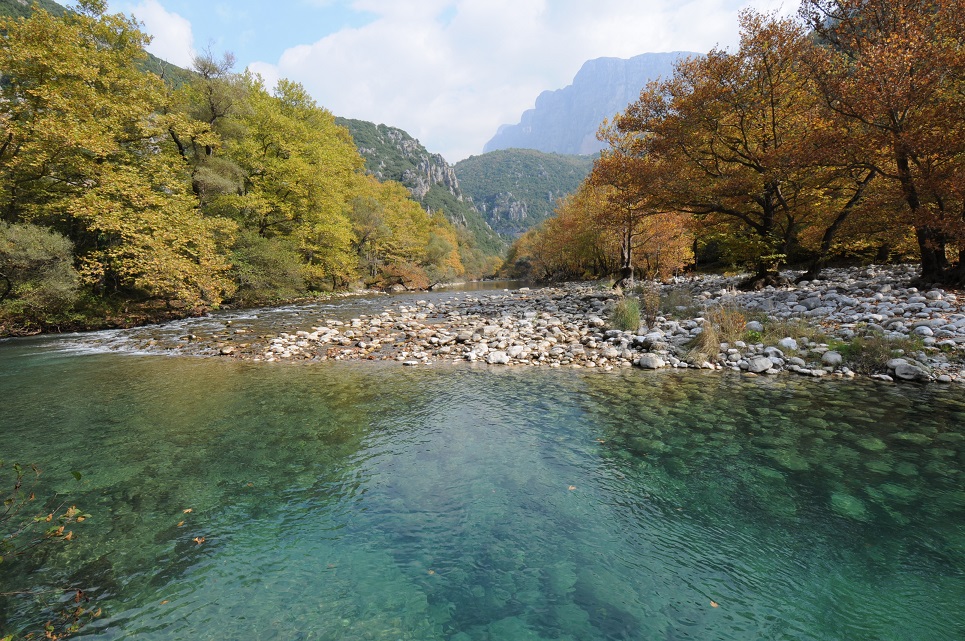
Goal: To provide a georeferenced database of species distribution in the basin of Aoos river, one of the last unfragmented free-flowing rivers in Europe, with special focus on the part of the area that is under no protection status. The project assessed different microhabitats of Aoos’ catchment in terms of their ecological value for the target species, as well as potential pressures and threats. Targeted species included large mammals, the otter and the dragonflies. The project suggested establishing a cross-border national park of Aoos between Greece and Albania.
Period: 2019. Funding: Pindos Perivallontiki (NGO) (Funds from Euronatur). Institute: BCL - University of Ioannina. Role: Coordinator. View the report here
Goal: Contribute to wolf-human conflict mitigation in Tzoumerka National Park. The project assesses and describes traditional free-ranging livestock raisers’ profile, records wolf depredation levels on cattle, sheep and goat herds as the main baseline metric of wolf-human conflicts in Tzoumerka NP, identifies and evaluates the principal damage prevention methods adopted by local livestock farmers, assesses levels of livestock guarding dog mortality due to the illegal use of poisoned baits as a major conservation problem and evaluates satisfaction levels of livestock farmers regarding the national compensation system.
Period: 2018. Funding: WWF-Hellas. Institute: BCL - University of Ioannina. Role: Coordinator. More info here
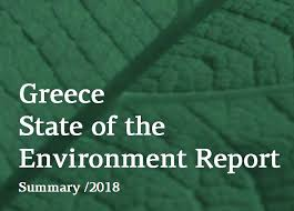
Goal: Assess the environmental progress of Greece in terms of indicators (SEBI) in the field of nature conservation. The project output was the national environmental report of the country, assessing the progress of Greece to achieve its biodiversity goals, using the system of the Streamlining Biodiversity Indicators of the European Environmental Agency.
Period: 2017. Funding: National Center of Environment and Sustainable Development. Institute: BCL - University of Ioannina. Role: Coordinator. View the report here
Goal: Increasing scientific knowledge about the distribution, population and genetic profile of poulations of the endemic and critically endangered grasshopper species (Chorhippus lacustris), with the aim of preserving it in practice. The program provided transfer of know-how to the staff of the Lake Pamvotida Management Agency, which since then monitors the status of the species populations on annual basis (the first invertebrate monitoring scheme in Greece).
Period: 2016-2017. Funding: Mohamed bin Zayed Species Conservation Fund. Institute: University of Patras. Role: Coordinator. More info here
Goal: result dissemination (open access papers) of research undertaken by the PhD student D. Vassilakis concerning the sustainable spatial planning of windfarms so as to minimize the mortality of cinereous vulture in Thrace.
Period: 2015-2017. Funding: Natural Research LtD Company, Scotland. Institute: University of Patras. Role: Coordinator. Relevant paper: Vasilakis et al. 2017
Goal: Set up a spatial database for the grasshopper species in the National Park of Tzoumerka and increase the ecological knowledge of their habitat requirements and human pressures/ threats affecting their populations, to improve their conservation status.
Period: 2015-2017. Funding: Epirus Development Society AE. (funds from Greek Ministry of Environment). Institute: University of Patras. Role: Coordinator.
Goal: Monitoring the amphibian and reptile species of community interest in five sites of the Natura 2000 network and assessing their conservation status in every site of the network.
Period: 2013-2015. Funding: Hellenic Herpetological Society (funding from the Greek Ministry of Environment). Institute: University of Patras. Role: Coordinator
Goal: Monitoring and assess the conservation status of all terrestrial invertebrate species of Community Interest occurring Greece and report on their conservation status under the Article 17 of the Habitats’ Directive.
Period: 2013-2015. Funding: NCC Company (funding from the Greek Ministry of Environment). Institute: University of Athens (A. Legakis). Role: Coordinator of the butterfly group, methodology setting for grasshoppers and dragonflies (University of Patras).
Goal: Collect data on the distribution and population size of insects, with special focus on Lycaena dispar (butterfly) in the lagoon of Messologi to assess its conservation status in the area.
Period: 2013-2015. Funding: NERCO Company (funding from the Greek Ministry of Environment). Institute: University of Patras. Role: Coordinator.
Goal: Collect data on the distribution and population status of amphibians, reptiles and a beetle species (Osmoderma eremita) of Community Interest in the area of Kalamas, and report on their conservation status in the area.
Period: 2013-2015. Funding: OIKOM Company (funding from the Greek Ministry of Environment). Institute: University of Patras. Role: Coordinator and researcher (herpetology/entomology),
Goal: Assess the biodiversity importance and the social value of sacred groves in the area of Epirus The biodiversity group collected data from vegetation, lichens, birds, and bats and published a relevant paper together with other members of the consortium.
Period: 2012-2015. Funding: Greek Ministry of Development (ESPA) and European Union (European Social Funds). Institute: University of Ioannina. Coordinator: J.M. Halley. Role: Researcher (ornithologist) and coordinator of the biodiversity group I (vegetation, lichens, birds, bats). Relevant papers: Avtzis et al 2018; Muggia et al. 2018. More info here.
Nota: New independent research from BCL contradicts the project outputs and underlines the significantly greater ecological value of sacred groves as “biodiversity refugia” for bird communities vs managed oak woods for birds (passerines, woodpeckers) considering organismal, functional and phylogenetic diversity. Benedetti et al. 2021
Goal: To assess the impact of the agricultural land abandonment on landscape change, on woody species and bird diversity and conclude to measures that contribute to biodiversity conservation. A common methodology for woody species, landscape structure and bird sampling was applied in Greece, Albania, Bulgaria and Croatia, whilst Austria was involved in landscape analysis. The project provided concrete evidence on the negative impact of land abandonment for biodiversity and the positive role of mild grazing in the mid-elevation former agricultural landscapes.
Period 2010-2012. Funding: SEE-ERA.NET PLUS CALL (FP7). Institute: University of Ioannina. Role: Coordinator of the international projects involving five countries. Relevant papers: Zakkak et al. 2018, Dyulgerova et al. 2015, Zakkak et al. 2015a, Zakkak et al. 2015b. More info here
Goal: Increase the knowledge of the diversity patterns of flora and invertebrate fauna (butterflies and grasshoppers) in the island of Cyprus, along an elevation gradient, and conclude to conservation measures for the target taxa under the light of climate change.
Period: 2010-2013. Funding: Institute of Research Promotion of Cyprus (PENEK Scheme). Institute: Frederick University, Cyprus Coordinator (K. Kadis). Role: Co-supervisor of PhD thesis, involved in sampling design and methodology setting of the project. Relevant paper: Tzirkalli et al. 2019
Goal: Special environmental studies updating the species list and relevant ecological information of the two Natura 2000 sites through fieldwork.
Period: 2008-2009. Funding: Epirus Development Society AE. Institute: University of Ioannina. Role: Coordinator and researcher (ornithologist).
Goal: Evaluation of the conservation status of habitats as well as the landscapes in the Northern Pindos National Park.
Period: 2008.Funding: Management Agency of Northern Pindos National Park under Interreg IIIA/Cards, Greece-Albania Scheme. Institute: University of Ioannina. Coordinator: P. Dimopoulos. Role: Researcher (landscape ecology).
Goal: To develop an integrated information system for common monitoring and management of similar ecosystems Greece and Italy (Greek case study: Kalamas Delta).
Period: 2006-2009. Funding: INTERREG IIIA, Greece-Italy. Institute: University of Ioannina. Coordinator: P. Dimopoulos. Role: Researcher (ornithologist-entomologist). Relevant paper: Kati et al. 2012
Goal: To provide guidelines for the adequate conservation management of riverine ecosystems.
Period: 2005-2008. Funding: INTERREG IIIC – Sud/ FEDER. Institute: University of Ioannina. Coordinator: P. Dimopoulos. Role: Researcher (ornithologist).
Goal: To provide the first geospatial biodiversity database of the mountains of central Pindos in Tzoumerka National Park, through fieldwork concerning the habitats, the flora and the fauna of the study area. Animal taxa covered: grasshoppers, butterflies, fish, amphibians, reptiles, small birds (passerines and woodpeckers), small mammals (rodents and insectivorous), bats, as well as the otter and the chamois. The project's ultimate goal was to feed the forthcoming special environmental study with data, in order to contribute to the adequate land-use zoning of the National Park.
Period: 2004-2007. Funding: Hellenic Ministry of Education (Pythagoras II Scheme). Institute: University of Ioannina. Coordinator: P. Dimopoulos. Role: Researcher (insects, birds) and coordinator of the fauna group.
Goal: Undertake the Special Environmental Study of the broader Tzoumerka area, concluding to an adequate zoning system of land uses for the conservation of biodiversity, under the scope to announce a new national park.
Period: 2004-2005. Funding: Epirus Development Society AE. Coordinator. H. Papaioannou. Role: Researcher (entomologist-ornithologist).
Goal: Provide the first geospatial bird database of Pindos National Park through fieldwork, covering different habitat types, assessing their value for conservation, while suggesting adequate conservation measures for bird diversity. The project included environmental education activities, such as university student training and seminars.
Period: 2003-2004. Funding: Hellenic Ministry of Environmental and Public Works (Environmental Protection and Sustainable Development Scheme). Institute: Pindos Perivallontiki & University of Ioannina. Role: Coordinator and researcher (ornithologist). Relevant paper: Kati et al. 2009
Goal: Studying the impact of grazing on plant diversity, taking as a study area the Bourazani Environmental Park.
Period: 2002-2004. Funding: Ministry of Development and General Secretariat of Research, Common Research and Technological Projects of Greece and Germany. Institute: University of Ioannina. Coordinator P. Dimopoulos. Role: Researcher (entomologist).
Goal: Studying and mapping biodiversity in Xiromeros oak forest.
Period: 2002-2003. Funding: Hellenic Ministry of Environmental and Public Works (Environmental Protection and Sustainable Development Scheme). Institute: University of Ioannina. Coordinator: P. Dimopoulos. Role: Researcher (ornithologist)
Goal: A WWF long term project for Northern Pindos National Park.
Period: 2001-2003. Funding: WWF-Greece. Institute: WWF Greece. Coordinator: H. Papaioannou. Role: Researcher for the monitoring and conservation management of Balkan chamois population. Relevant paper: Papaioannou & Kati 2007
Publications
Publications include (a) international peer reviewed papers, (b) book chapters, (c) papers in conference proceedings, (d) published datasets, (e) selected reports. Links for accessing pdfs are provided
*: corresponding author.
![]() Paper without Impact Factor.
Paper without Impact Factor.
Biological group
Topic
PhD thesis
The current research is conducted in the framework of conservation biology, taking as a case study the reserve of Dadia, in NE Greece. Biological diversity is represented by six biological groups: vegetation, orchids, Orthoptera, aquatic and terrestrial herpetofauna, and small terrestrial birds. The diversity and the ecological structure of the group communities are assessed and analyzed for 36 sites, which represent different habitat types in the Dadia reserve. Five conservation scenarios are constructed to design optimal reserve networks for the conservation of biodiversity. They support the scoring versus approach, the principle of complementarity, of biological representativeness, of environmental representativeness, and finally the random design of reserve systems. Their efficiency is tested and their utility is discussed. The degree of coincidence of hotspots and of the optimal network for different groups is measured, as well as the surrogate value of each studied group as a shortcut for the conservation of the other groups and of overall biodiversity. Finally, we discuss practical conservation issues for the reserve of Dadia.
Papers
Petridou, M., Kati, V. 2025. Are Wolves the Real Problem? Challenges Faced by Livestock Farmers Living Alongside Wolves in Northwestern Greece. Sustainability (Switzerland) 17 (3):1083.
Stefanidis, A., Kougioumoutzis, K., Zografou, K., Fotiadis, G., Willemse, L., Tzortzakaki, O., & Kati, V. 2025. Distribution Patterns and Habitat Preferences of Five Globally Threatened and Endemic Montane Orthoptera (Parnassiana and Oropodisma). Ecologies, 6(1), 5.
Papakostas, K., Papaioannou, H., Apollonio, M., Kati, V. 2025. Seasonal distribution pattern and habitat selection of the Balkan chamois on Olympus mountain: Summer heat, hikers, roads. Journal for Nature Conservation 83:126773
Stefanidis, A., Kougioumoutzis, K., Zografou, K., Fotiadis, G., Tzortzakaki, O., Willemse, L., Kati, V. 2024. Mitigating the extinction risk of globally threatened and endemic mountainous Orthoptera species: Parnassiana parnassica and Oropodisma parnassica. Insect Conservation and Diversity, 1–15.
Sidiropoulos, L., Whitfield, D.P., Poirazidis, K., Navarrete, E., Vasilakis, D.P., Bounas, A., Kret, E., Kati, V. 2024. Dispersal Ecology of Golden Eagles (Aquila chrysaetos) in Northern Greece: Onset, Ranging, Temporary and Territorial Settlement. Diversity, 16, 580.
Tzirkalli, E., Zografou, K., Willemse, L., Vogiatzakis, I.N., Kati, V., 2024. Conservation Prioritization of Orthoptera Assemblages on a Mediterranean Island. Diversity, 16 (6), 347.
Grubert,E., Benites Lazaro,L.L., Popp, A., Merfort, L., Luo, T., Kati, V., Meshram, P., Dorn, F.M., Hernández, D. (2024) Making low-carbon energy sustainable, One Earth, 7(2):163-166-
Hua, F. et al. 2024. Ecological filtering shapes the impacts of agricultural deforestation on biodiversity. Nature Ecology & Evolution (8):251-266
Stefanidis, A.; Zografou, K.;Tzortzakaki, O.; Kati, V. OrthopteraCommunity Dynamics andConservation in a Natura 2000 Site(Greece): The Role of Beta Diversity.Diversity2024,16, 11; https://doi.org/10.3390/d16010011
Toli, E.-A., Zacharopoulou, P., Bounas, A., Kati, V., Sotiropoulos, K. 2023. Conservation genetics of the steno-endemic Chorthippus lacustris (Orthoptera: Acrididae). Journal of Insect Conservation.
Petridou, M., Benson, J.F., Gimenez, O., Iliopoulos, Y., Kati, V. 2023. Do husbandry practices reduce depredation of free-ranging livestock? A case study with wolves in Greece. Biological Conservation 283, 110097
Kati, V., Petridou, M., Tzortzakaki, O., Papantoniou, E., Galani, A., Psaralexi, M., Gotsis, D., Papaioannou, H., Kassara, C. 2023. How much wilderness is left? A roadless approach under the Global and the European Biodiversity Strategy focusing on Greece. Biological Conservation 281, 110015.
Toli, E.-A., Zacharopoulou, P., Bounas, A., Kati, V., Sotiropoulos, K. 2023. Conservation genetics of the steno-endemic Chorthippus lacustris (Orthoptera: Acrididae). Journal of Insect Conservation. https://doi.org/10.1007/s10841-023-00507-6
Grigoropoulou, A. et al., 2023. The global EPTO database: Worldwide occurrences of aquatic insects. Global Ecology and Biogeography, 32: 642–655
Petridou, M., Benson, J.F., Gimenez, O., Kati, V. 2023. Spatiotemporal Patterns of Wolves, and Sympatric Predators and Prey Relative to Human Disturbance in Northwestern Greece. Diversity 15.
Kati, V., Selva, N., Sjögren-Gulve, P., 2022. Greek roadless policy: A model for Europe. Science 375 984.
Lemonnier-Darcemont, Μ., Zechner, L., Kati, V., Filis, N., Darcemont, C. 2022. Occurrence and threats of Prionotropis willemsorum (Massa & Ünal, 2015) in Greece. Articulata 37: 1-12
Sidiropoulos, L., Whitfield, D.P., Astaras, C., Vasilakis, D., Alivizatos, H., Kati, V*., 2022. Pronounced Seasonal Diet Diversity Expansion of Golden Eagles (Aquila chrysaetos) in Northern Greece during the Non-Breeding Season: The Role of Tortoises. Diversity 14. 10.3390/d14020135
Benedetti, Y., Kapsalis, E., Morelli, F., Kati, V.* 2021. Sacred oak woods increase bird diversity and specialization: Links with the European Biodiversity Strategy for 2030. Journal of Environmental Management, 294, 112982
Kati, V*., Kassara, Ch., Vrontisi, Z., Moustakas, A. 2021. The biodiversity-wind energy-land use nexus in a global biodiversity hotspot. Science οf the Total Environment, 768, 144471.
Zografou, K., Grill, A., Wilson, R.J., Halley, J.M., Adamidis, G.C., Kati, V. 2020. Butterfly phenology in Mediterranean mountains using space‐for‐time substitution. Ecology and Evolution, 10: 928– 939.
Kati, V., Kassara, Ch., Vassilakis, D., Papaioannou, H. 2020. Balkan Chamois (Rupicapra rupicapra balcanica) Avoids Roads, Settlements, and Hunting Grounds: An Ecological Overview from Timfi Mountain, Greece. Diversity, 12 (4), pp 124.
Tzirkalli, E., Kadis, C., Halley, J.M., Vogiatzakis, I., Wilson, R.J., Zografou, K., Antoniou, A., Tsintides, T., Makris, C., Kati, V*., 2019. Conservation ecology of butterflies on Cyprus in the context of Natura 2000. Biodiversity and Conservation. 28(7), 1759-1782.
Maes, D., et al. 2019. Integrating national checklists and Red Lists for prioritising European butterfly conservation actions. Journal of Insect Conservation 22 (2):301-330,
Tzortzakaki, O., Kati, V., Panitsa, M., Tzanatos, E., Giokas, S. 2019. Butterfly diversity along the urbanization gradient in a densely-built Mediterranean city: Land cover is more decisive than resources in structuring communities. Landscape and Urban Planning 183: 79-87.
Tzortzakaki, O., Papadatou, E., Kati, V., and Giokas, S. 2019. Winners and losers in an urban bat community: a case study from southeastern Europe. Hystrix, the Italian Journal of Mammalogy, 30(2), pp.0.
Petridou, M, Youlatos, D., Lazarou, Y., Selinides, K., Pylidis, Ch., Giannakopoulos, A., Kati, V. Iliopoulos, Y. 2019. Wolf diet and livestock selection in central Greece. Mammalia
Muggia, L., Kati, V., Rohrer, A., Halley, J., Mayrhofer, H. 2018. Species diversity of lichens in the sacred groves of Epirus (Greece). – Herzogia 31: 231–244.
Avtzis, D.N., et al. 2018. Quantifying the conservation value of Sacred Natural Sites. Biological Conservation 222: 95-103.
Zakkak, S., Radovic, A., Panitsa, M., Vassilev, K., Shuka, L., Kuttner, M., Schindler, S., Kati, V*. 2018. Vegetation patterns along agricultural land abandonment in the Balkans. Journal of Vegetation Science 29: 877-886.

Lemonnier-Darcemont, M., Kati, V., Willemse, L., Darcemont, C. 2018. Effects of changing grazing systems on the threatened genus Peripodisma (Orthoptera: Acrididae: Melanoplinae) in the Mediterranean mountains of the southern Balkans. Journal of Mediterranean Ecology 16: 67-79.
Tzortzakaki, O., Kati, V., Kassara, C., Tietze, D.T., Giokas, S. 2017. Seasonal patterns of urban bird diversity in a Mediterranean coastal city: the positive role of open green spaces. Urban Ecosystems. 21(1): 27-39.
Zografou, K., Wilson, R.K., Halley, J.M., Tsirkalli, E., Kati V. 2017. How are arthopod communities structured and why are they so diverse? Answers from Mediterranean mountains using hierarchical additive partitioning. Biodiversity and Conservation 26(6): 1333-1351.
Zografou, K., Adamidis, G., Komnenov, M., Kati, V., Sotirakopoulos, P., Pitta, E., Chatzaki, M. 2017. Diversity of spiders and orthopterans responds to intra-seasonal and spatial environmental changes. Journal of Insect Conservation 21(3): 531-543.
Hudson, L.N. et al. 2017. The database of the PREDICTS (Projecting Responses of Ecological Diversity In Changing Terrestrial Systems) project. Ecology and Evolution 7: 145-188.
Slancarova, J., Bartonova, A.,Zapletal, M., Kotilinek, M., Fric, Z., Micevski, N., Kati, V. Beshkov, S., Konvicka, M. 2016. Life History Traits Reflect Changes in Mediterranean Butterfly Communities due to Forest Encroachment. PLoS ONE 11(3): e0152026.
Zografou, K., Adamidis, G.K., Grill, A., Kati, V., Wilson, R.J., Halley, J.M. 2015. Who flies first? Habitat-specific phenological shifts of butterflies and orthopterans in the light of climate change: a methodological case study from south-east Mediterranean. Ecological Entomology 40: 562-574.
Zakkak, S., Halley, J.M., Akriotis, T., Kati, V. 2015. Lizards along an agricultural land abandonment gradient in Pindos Mountains, Greece. Amphibia-Reptilia 36: 253-264.
Radović, A., Perĉec Tadić, M., Denac, D., Kati, V., Jelaska, S., Kotrošan, D. 2015. Modelling the spatial distribution of the White Stork (Ciconia ciconia) breeding populations in the Southeast Europe. 2015. Bird Study 62 (1):106-114.
Schindler, S., von Wehrden, H., Poirazidis, K., Hochachka, W.M., Wrbka, T., Kati, V. 2015. Performance of methods to select landscape metrics for modelling species richness. Ecological Modelling 295: 107-112.
*Kati, V., Hovardas, T., Dieterich, M., Ibisch, P.L., Mihok, B., Selva, N. 2015. The Challenge of Implementing the European Network of Protected Areas Natura 2000. Conservation Biology 29 (1):260-270.
Papaioannou, Η., Sgardelis, S., Chondropoulos, B., Vassilakis, D., Kati, V., Dimopoulos, P. 2015. Demographic characteristics, seasonal range and habitat topography of Balkan chamois population in its southernmost limit of its distribution (Giona mountain, Greece). Journal of Natural History 49 (5-8):327-345.
Dyulgerova, S., Gramatikov, M., Pedashenko, M., Vassilev, K., Kati, V., Nikolov, S.C. 2015. Farmland birds and agricultural land abandonment: Evidences from Bulgaria. Acta Zoologica Bulgarica 67 (2): 223-234.
Hudson, L. N., T. et al. 2014. The PREDICTS database: a global database of how local terrestrial biodiversity responds to human impacts. Ecology and Evolution 4(24): 4701-4735.
Zografou, K., Kati, V., Grill, A., Wilson, R.J., Tzirkalli, E., Pamperis, N.L., Halley, J.M. 2014. Signals of climate change in butterfly communities in a Mediterranean protected area. PlosOne. 9 (1), e87245.
Zakkak, S., Kakalis, E., Radovic, A., Halley, J.M., Kati, V. 2014. The impact of forest encroachment after agricultural land abandonment on passerine bird communities: The case of Greece. Journal for Nature Conservation 22 (2): 157-165.
Miculic, K. Radovic, A., Kati, V., Jelaska, S., Tepic, N. 2014. Effects of land abandonment on bird communities of smallholder farming landscapes in post-war Croatia: implications for conservation policies. Community Ecology 15(2): 169-179.
Zakkak, S., Chatzaki, M., Karamalis, N., Kati, V. 2014. Spiders in the context of agricultural land abandonment in Greek Mountains: species responses, community structure and the need to preserve traditional agricultural landscapes. Journal of Insect Conservation 18 (4): 599-611.
Willemse, L., Kati, V, Odé, B. 2014. Epirus Grasshopper: a Prima Ballerina Courtship! In: Hegan, A (ed), No More Endlings: saving species one story at a time, Motivational Press, Melbourne, 246-253.
Schindler, S., von Wehrden, H., Poirazidis ,K., Wrbka, Th., Kati, V. 2013. Multiscale performance of landscape metrics as indicators of species richness of plants, insects and vertebrates. Ecological Indicators 31: 41– 48.
*Kati, V., Zografou, K., Tzirkalli, E., Chitos, Th., Willemse, L. 2012. Butterfly and grasshopper diversity patterns in humid Mediterranean grasslands: the roles of disturbance and environmental factors. Journal of Insect Conservation 16 (2): 807-818.
Schindler, S., Curado, N., Nikolov, S., Kreft, E., Carcamo B., Catsadorakis G., Poirazidis, K, Kati V. 2011. From research to implementation: nature conservation in the Eastern Rhodopes mountains, European Green Belt (Greece and Bulgaria). Journal for Nature Conservation 19:193-201.
*Kati, V. Poirazidis, K., Dufrêne, M., Halley, J.M., Korakis, G., Schindler, S. Dimopoulos P. 2010. Towards the use of ecological heterogeneity to design reserve networks: a case study from Dadia National Park, Greece. Biodiversity & Conservation 19 (6): 1585-1597.
Michaelides, G., *Kati, V. 2009. Diversity patterns and conservation management of the lizard community in a Mediterranean reserve, Cyprus. Journal of Biological Research 12: 211-220.
Pullin, A.S., Báldi, A., Can, O.E., Dieterich, M., Kati, V., Livoreil, B., Lövei, G., Nevin, O., Selva, N., Sousa-Pinto, I. 2009. Conservation Focus on Europe: Major conservation policy issues that need to be informed by conservation science. Conservation Biology 23 (4): 818-824.
*Kati, V., Dimopoulos, P., Papaioannou, H., Poirazidis, K. 2009. Ecological management of a Mediterranean mountainous reserve (Pindos National Park, Greece) using the bird community as an indicator. Journal for Nature Conservation 17 (1): 47-59.
Zografou, K., Sfenthourakis, S., Pullin, A., *Kati, V. 2009. On the surrogate value of red-listed butterflies for butterflies and grasshoppers: a case study in Grammos site of Natura 2000, Greece. Journal of Insect Conservation 13: 505-514.
Poirazidis, K., Goutner, V., Tsachalidis, E., Kati, V. 2007. Comparison of nestsite selection patterns of different sympatric raptor species as a tool for their conservation. Animal Biodiversity and Conservation 30 (2):131-145.
*Kati, V., Foufopoulos, J., Ioannidis, Y., Papaioannou, H., Poirazidis, K., Lebrun, Ph. 2007. Diversity, ecological structure and conservation of herpetofauna in a Mediterranean area (Dadia National Park, Greece). Amphibia-Reptilia 28: 517-529.
Sjögren-Gulve, P., Långström, E., Báldi, A., Ibisch, P., Kati, V., Livoreil, B., Selva, N. 2007. Conservation biology and the 300th anniversary of the birth of Carl Linnaeus. Conservation Biology 21 (4): 905-906.
Papaioannou, H., *Kati, V. 2007. Current status of the Balkan chamois (Rupicapra rupicapra balcanica) in Greece: implications for conservation. Belgian Journal of Zoology 137 (1): 33-39.
*Kati, V., Sekercioglu, C.H. 2006. Diversity, ecological structure, and conservation of the landbird community of Dadia reserve, Greece. Diversity and Distributions 12: 620-629.
*Kati, V., Mani, P., von Helversen, O., Willemse, F., Elsner, N., Dimopoulos, P. 2006. Human land use threatens endemic wetland species: the case study of Chorthippus lacustris (Orthoptera: Acrididae) in Epirus, Greece. Journal of Insect Conservation 10: 65-74
Korakis, G., Gerasimidis, A., Poirazidis, K., Kati, V. 2006. Floristic records from Dadia-Lefkimi-Soufli National Park, NE Greece. Flora Mediterranea 16:11-32.
Grill, A., Knoflach, B., Cleary, D., Kati, V. 2005. Butterfly, spider, and plant communities in different land-use types: Sardinia, Italy. Biodiversity and Conservation 14: 1281-1300.
*Kati, V., Devillers, P., Dufrêne, M., Legakis, A., Vokou, D., Lebrun, Ph. 2004. Hotspots, complementarity or representativeness? Designing optimal small-scale reserves for biodiversity conservation. Biological Conservation 120 (4): 471-480.
*Kati,V., Dufrêne M., Legakis A., Grill A., Lebrun Ph. 2004. Conservation management for the Orthoptera in the Dadia reserve, Greece. Biological Conservation 115: 33-44.
*Kati, V., Willemse, F. 2001. The grasshoppers and crickets of the Dadia Forest Reserve (Thraki, Greece) with a new record to the Greek fauna: Paranocarodes chopardi Pechev 1965 (Orthoptera, Pamphagidae). Articulata 16: 11-19.
*Kati, V., Lebrun, Ph., Devillers, P., Papaioannou, H. 2000. Les orchidées de la réserve de Dadia (Grèce), leurs habitats et leur conservation. Les Naturalistes Belges 81: 269-282.
Conference Papers
Schindler, S., Kati, V., von Wehrden, I., Wrbka, T., and Poirazidis, K. 2009. Landscape metrics as biodiversity indicators for plants, insects and vertebrates at multiple scales. In: Breuste, J., Kozov?, M., and Finka, M. (Eds). European Landscapes in Transformation: Challenges for Landscape Ecology and Management. European IALE Conference 2009 12-16 Jul 2009, Salzburg, Austria & Bratislava, Slovakia. pp. 228-231.
Schindler, S., Kati, V., and Poirazidis, K. 2007. Testing the performance of landscape structure variables as predictors of biodiversity: a case study from Dadia NP, Greece. In: Bunce, RGH, Jongman, RHG, Hojas, L, and Weel, S., Eds. 25 Years of Landscape Ecology: Scientific Principles in Practice. Proceedings of the 7th IALE World congress, Wageningen, The Netherlands, 8-12 Jul. IALE Publications series 4. p 337-338.
Kati, V. 2001. Maximizing biodiversity conservation in a forest ecosystem by identifying zones of hotspot overlap. In: Radoglou, K. Proceedings of the International Conference: Forest Research: A Challenge For an Integrated European Approach, Thessaloniki. NAGREF – Forest Research Institute, p 581-585.
Book chapters
2010 - 2020
Brotons, L., Herrando, S., Sirami, C., Kati, V. & Díaz, M. 2017. Mediterranean forest bird communities and the role of landscape heterogeneity in space and time. In: Mikusinski, G., Roberge, J.-M. & Fuller, R.J. (Eds.). Ecology and Conservation of Forest Birds. Cambridge University Press. Cambridge, UK. pp 318-349.
Poirazidis, K., Schindler, S., Kati, V., Martinis, A., Kalivas, D., Kasimiadis, D., Wrbka, T., Papageorgiou, A. 2011. Conservation of biodiversity in managed forests: developing an adaptive decision support system. In: Li, C., Lafortezza, R., Chen, J. (eds), Landscape Ecology in Forest Management and Conservation. Challenges and Solutions for Global Change. Higher Education Press – Springer. pp 381-399.
2000 - 2010
Korakis, G., Gerasimidis, A., Kati, V. 2010. Τhe flora. In: Catsadorakis, G., Källander, H. (Eds.). The Dadia – Lefkimi – Soufli Forest National Park, Greece: Biodiversity, Management and Conservation. WWF Greece, Athens, pp 63-84.
Poirazidis, K., Kati, V., Schindler, S., Triantakonstantis, D., Kalivas, K., Gatzogiannis, S. 2010. Landscape and biodiversity in the Dadia –Lefkimi- Soufli Forest National Park. In: Catsadorakis, G., Källander, H. (Eds.). The Dadia – Lefkimi – Soufli Forest National Park, Greece: Biodiversity, Management and Conservation. WWF Greece, Athens. pp 103-114.
Kati, V*., Kakalis, L. 2010. The landbird community: composition, abundance and management suggestions In: Catsadorakis, G., Källander, H. (Eds.). The Dadia – Lefkimi – Soufli Forest National Park, Greece: Biodiversity, Management and Conservation. WWF Greece, Athens. pp 169-182
Grill, A., Kati, V., Karris, G., Argyropoulou, M.D. 2010. Diversity patterns in insect communities of the Dadia–Lefkimi–Soufli Forest National Park: butterflies, grasshoppers, beetles. In: Catsadorakis, G., Källander, H. (Eds.). The Dadia – Lefkimi – Soufli Forest National Park, Greece: Biodiversity, Management and Conservation. WWF Greece, Athens. pp 115-122.
Catsadorakis, G., Kati, V., Liarikos, K., Poirazidis, K., Skartsi, Th., Vasilakis, D. and Karavellas, D. 2010. Conservation and management issues for the Dadia Lefkimi Soufli Forest National Park. In: Catsadorakis, G., Källander, H. (Eds.). The Dadia – Lefkimi – Soufli Forest National Park, Thrace, Greece: Biodiversity, Management and Conservation. WWF Greece, Athens. pp 265-280.
Schindler, S., Poirazidis, K., Papageorgiou, A., Kalivas D.,Von Wehrden, H., Kati, V. 2010. Landscape approaches and GIS for biodiversity management. In: Andĕl, J., Bičik, I., Dostál, P., Lipskŷ, Z, Shahneshin, S.G., Raska, P. (eds), Landscape modelling: geographical space, transformation and future scenarios, Urban and Landscape Perspectives Series, Springer-Verlag. pp171-182.
Scientific reports
View reports

Κατή Β. & Βλαχόπουλος Κ. 2024. Μελέτη αντίκρουσης για την προστασία της φύσης στην περιοχή των βουνών της κεντρικής Εύβοιας (GR2420011) από την εγκατάσταση Αιολικών Σταθμών Παραγωγής Ενέργειας (ΜΠΕ: ΠΕΤ 2406011011). Εργαστήριο BCL, Πανεπιστήμιο Ιωαννίνων, Ιωάννινα, 79 σελ. https://doi.org/10.13140/RG.2.2.28482.70087
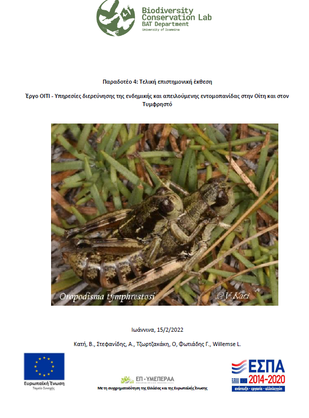
Kati V., Stefanidis A., Tzortzakaki O., Fotiadis G., Willemse L. 2022. Final Scientific Report: Project OITI-Investigating the endemic and threatened entomofauna in Oiti and Tymfristos. 56 p.
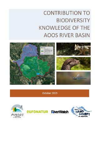
Kati V., Petridou M., Theodoropoulos Y., Bukas N. 2019. Contribution to biodiversity knowledge of the Aoos River Basin / Greece. Pindos Perivallontiki, 65pp
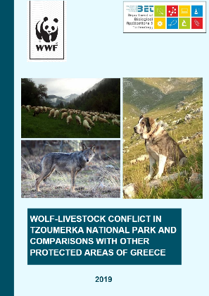
Petridou M., Iliopoulos Y., Kati V. 2019. Wolf-livestock conflict in Tzoumerka National Park and comparisons with other protected areas of Greece. University of Ioannina and WWF Greece. Ioannina, Greece, pp. 51.
Databases
View databases
Kassara C., Petridou M., Tzortzakaki O., Papantoniou E., Galani A., Psaralexi M., Gkotsis D., Papaioannou H., Kati V. 2022. The roadless map of Greece. Mendeley Data, v2.
Kati, V., Kassara, Ch. 2020. Sustainable spatial planning for windfarms in Greece. Mendeley Data, v1
Kati, V., Willemse, L. 2020. “Database of endemic and/or threatened Orthoptera species in the Natura 2000 sites of Greece.”, Mendeley Data, v1.
Kati V.,Kapsalis, E.2020. Bird communities in the sacred groves of Epirus, Greece. Mendeley Data, v1.
Kati V, Kassara C, Psaralexi M, Tzortzakaki O, Petridou M, Galani A, Hoffmann M. 2020. The roadless map of Greece. Mendeley Data, v1.
Popular science
View more
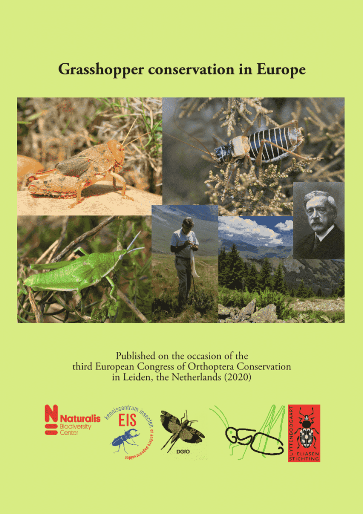
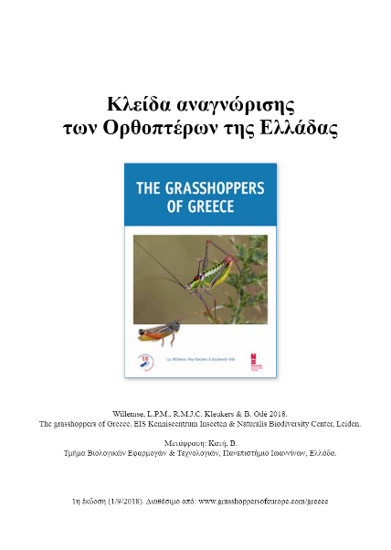
Willemse, L. & Kati, V. 2020. Greece. In: Kleukers, R. & R. Felix (eds.) 2020. Grasshopper conservation in Europe. EIS Kenniscentrum Insecten & Naturalis Biodiversity Center, Leiden: 35-37.
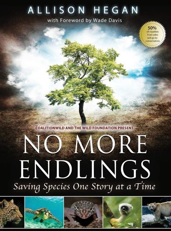
Willemse, L., Kati, V, Odé, B. 2014. Epirus Grasshopper: a Prima Ballerina Courtship! In: Hegan, A (ed), No More Endlings: saving species one story at a time, Motivational Press, Melbourne, 246-253.
Textbooks
View textbooks
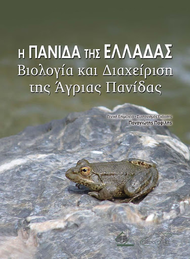
Kati, V. 2020. Threats and conservation of Greek fauna. In: Pafilis, P. (Ed). The fauna of Greece: Biology and management of wildlife. Broken Hill Publishers Ltd. Nicosia, Cyrpus. Pp 991-1021.
Service ships & distinctions
Editorial boards & reviewer
Editorial board: Diversity (2020-present). Journal for Nature Conservation (2013-2021). Scientific World Journal: Ecology ( 2013-2017) [open access]. International Journal of Biodiversity ( 2012-2018).
Reviewer in scientific Journals [>35]:
Project evaluator:
Societies and committees
International societies and committees
- IPBES: Intergovernmental Science-Policy Platform on Biodiversity and Ecosystem Services. Stakeholder. 2020-…
- NEMOR: Network for European Mountain Research. Founding Member/ Steering Committee. 2019-…
- BCE: Butterfly Conservation Europe BCE: Butterfly Conservation Europe. Focal point.2020-…
- Orthopterists’ Society. Member. 2020-…
- SCB-Europe Section.National Focal point. 2004-… [BoD-Board of Directors. Chair of Education Committee. Global Education Committee (2007-2010)]
- SCB-PC: Policy Committee of SCB-Europe. Member. 2004-…
- IUCN-GSG: IUCN-Grasshopper Specialist Group. Member. 2013-…
- Roadless initiative: Member. 2007-…
- DG Environment. Member of the committee «Ad Hoc Expert Working Group on Biodiversity and Climate Change» [2009-2013]
National societies and committees
- HELECOS: Hellenic Ecological Society. 2014-2016. General Secretary. [Member since 2003]
- Hellenic Zoological Society. Member 2003-…
- ELERPE: Hellenic Herpetological Society. Member. 2012-…. [Board Member: 2015-2017].
- CITES committee. Alternate Board Member. 2011–2014.
- Management Body of Pamvotis Lake. 2003-2005. Board Member.
Congresses & summer schools’ organization
- 6 international congresses
- 3 national congresses
- 3 summer schools
- Greek Summer School in Conservation Biology: Biodiversity Theory and Practice. Participant: 2014-2019. (http://gss.bat.uoi.gr).
- Conservation Biology in Europe: building a coherent strategy for the future. 2010–2012. Chair.
- Erasmus Intensive Programme. State Scoraships Foundation (IKY). Chair.
- Greek Summer School (GSS) “Introduction to Conservation Biology”. 2008-2009. Chair. Society for Conservation Biology, University of Ioannina, and Center of Biological & Cultural Diversity.
- Greek Summer School in Conservation Biology: Biodiversity Theory and Practice. Participant: 2014-2019. (http://gss.bat.uoi.gr).
Invited lectures
Hellenic Society of Biological Sciences (congress), University of Vienna, Universität Goettingen, Universität Erlangen-Nürnberg,
Invitations as expert
2019. Invited as biodiversity expert from the Greek Ministry of Environment and Energy to take part in the Environmental Performance Review – EPR of Greece from OECD. 25-28/6/2019.
2017. Invited as biodiversity expert from DG Environment to the Natura 2000 Biogeographical Process – 2nd Mediterranean Natura 2000 Seminar. Limassol, Cyprus. 14 to 16/11/2017
2009-2013. Invited as biodiversity expert by the DG Environment, Nature and Biodiversity to take part in the «Ad Hoc Expert Working Group on Biodiversity and Climate Change»
2009. Invited as biodiversity expert by the DG Environment, Nature and Biodiversity, to take part in two symposia in the-2nd European Congress of Conservation Biology, 1-5 Sept, Prague, Czech Republic
Scholarships & Awards
- 2005. Grant from Bodossaki Institute to represent Greece in the congress “DIVERSITAS – Integrating biodiversity science for human well-being”. Oaxaca, Mexico.
- 2003. Award for doctoral thesis quality held by the Hellenic Ministry of Environment and Public Works, after evaluation of the National Natura 2000 Committee.
- 2000-2001. Scholarship from Alexandros S. Onassis Institute as Doctoral student.
- 1997-1999. Scholarship from Bodossaki Institute as Doctoral student.
- 1995-1996. Erasmus scholar of State Scolarships Foundation-IKY for one year
- 1992-1995. Grant from State Scolarships Foundation-IKY for the best undergraduate student in Biology Department (Aristotle University of Thessaloniki).
Teaching
Current
- Biodiversity and climate change. BAT Department. Core course. 6 ECTS
- Conservation Biology in practice. BAT Department. Optional course. 4 ECTS
- Field Ecology. BAT Department. Optional course. 5 ECTS
- Interdisciplinary approaches to the present state of the Mediterranean: case studies. MSc course: “Environmental sciences & and education for sustainability” [University of Ioannina]. Optional course. 3 ECTS
Former
International courses
- Biodiversity conservation – environmental management (Institut für Zoologie II, Universität Erlangen-Nürnberg: 2002).
- Introduction to Conservation Biology (International summer school GSS: 2008-2009).
- Conservation Biology in Europe: Building a coherent strategy for the future (Erasmus IP: 2010-2012).
- Conservation Biology: Biodiversity Theory and Practice (International summer school GSS: 2014-2015).
Postgraduate courses:
- MSc “Environmental management and protection applications” [University of Patras, 2015-2017]. Courses: Environmental data analysis and simulation processes; Ecosystems, environmental risks management; Fieldwork techniques
- MSc “Sustainable Management of Protected areas” [University of Ioannina, Aristotle University of Thessaloniki, University of Patras, 2004-2012]: Sampling design of biotic parameters and statistical analysis; Biodiversity-introduction; Sustainability and Conservation.
Undergraduate courses:
- Biodiversity Conservation
- Wild fauna management
- Protected areas management
- Monitoring of habitats and species
- Plant Ecology
- Environmental Planning and Sustainable Development
- General Biology
PhD student supervision
View more
- Nasiou K. 2024-…”Impact of climate change and livestock grazing on insect communities and pollination in mountainous grasslands of Greece”. BAT Department. Advisory Committee: Prof T. Tscheulin (University of Aegean), A. Radovič (Ruđer Bošković Institute, Croatia).
- Stefanidis A. 2022-…”Ecology and conservation of mountainous Orthoptera communities, emphasizing endemic and threatened species (Greece).” BAT Department. Advisory Committee: Prof. S. Giokas (University of Patras), Assoc. Prof. G. Fotiadis (Agricultural University of Athens).
- Papakostas K. 2022-…”Balkan chamois (Rupicapra rupicapra balcanica) ecology and conservation in Greece.“BAT Department. Advisory Committee: M. Apollonio (Universita degli studi di Sassari), Dr. C. Astaras (Hellenic Agricultural Organisation DIMITRA-ELGO)
- Sidiropoulos L. 2018-… “Conservation ecology of the golden eagle: the case of Northern Greece.” BAT Department. Advisory Committee: Ass. Prof. Kostas Poirazidis (Ioanian University), Dr. Christos Astaras (Hellenic Agricultural Institute – DIMITRA).
Accomplished
- Petridou M. 2018-2023 “Wolf ecology and predation behavior: a conflict minimization strategy towards sustainable livestock breeding”. BAT Department. Advisory Committee: Dr. Olivier Gimenez (CNRS, France), Ass. Prof. John F. Benson (University of Nebraska Lincoln, USA).
- Tzirkalli E. 2010-2022 (supervisor since 2017): «Biodiversity patterns versus local climate change in Cypurs». BAT Department. Advisory Committee: Prof. J.M. Halley (University of Ioannina), Prof. I. Vogiatzakis (Open University of Cyprus).
- Vasilakis D. 2011-2016. « Cinereous vulture (Aegypius monachus) conservation and management in S.E. Europe: modeling its movement ecology for the sustainable spatial planning of wind farms». Department of Environmental & Natural Resources Management, University of Patras. Advisory Committee: Prof. S. Sgardelis (Aristotle University of Thessaloniki), Ass. Prof. N. Koutsias (University of Patras).
- Zakkak S. 2010-2015. «Impact of agro-pastoral abandonment on landscape structure and biodiversity.» Department of Environmental & Natural Resources Management, University of Patras. Advisory Committee: Ass. Prof. T. Akriotis (University of Aegean), Prof. J. M. Halley (University of Ioannina).
Co-supervisor of PhD theses: 6
Evaluator of PhD theses: 10
Supervisor of MSc theses: 15
Supervisor of diploma theses: 12
See here for recent MSc students supervised